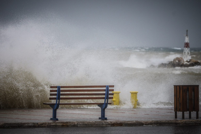
The weather becomes harsher in the following days, with meteorologists talking about “express” bad weather conditions. The meteorologist, Mr. Sakis Arnaoutoglou, talks about a jet stream that starts with gusts of 240km/h in its inside and will be weakened as it moves east.
In particular, he states in a post: “It is not something that we every day in the forecast maps! We are talking about a jet stream, the gusts of which will reach 240km/h in its inside. This jet stream will be at 5,000 meters above the sea level, at Sunday night (6/2), and it will move from the east of England to the Netherlands!
Moving east and gradually weakening, this jet stream is supposed to bring about an EXPRESS weather deterioration late at night, first to the Northern Greece and, on Tuesday 8/2, in most parts of our country, causing very strong to severe north winds in some places, not only in sea but also on land, with gusts that may locally exceed 9-10 Beaufort, as I mentioned in the weather reports of ERT3 channel, in the previous days “.
Strong winds in Thessaloniki
In another post, Mr. Sakis Arnaoutoglou states: “The atmospheric pressure diving on Monday is impressive! The atmospheric pressure in Thessaloniki is expected to drop to almost 20hpa in about 36 hours! In similar cases, in the past, in Thessaloniki, there were cases where gusts reached 80plus kilometers per hour (i.e. 9plus Beaufort) !!!”